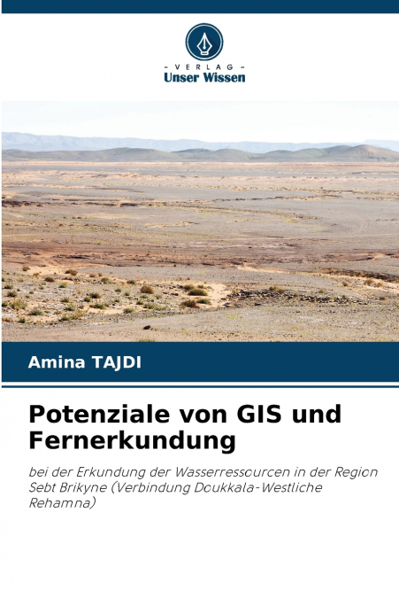
Potenziale von GIS und Fernerkundung

Potenziale von GIS und Fernerkundung

Amina TAJDI

63,07 €
IVA incluido
Disponible
Editorial:
KS OmniScriptum Publishing
Año de edición:
2023
Materia
Geología y la litosfera
ISBN:
9786206900955
63,07 €
IVA incluido
Disponible
Añadir a favoritos

In diesem Buch wird eine Studie vorgestellt, die durch die Verwendung von Satellitenbildern und Geographischen Informationssystemen potenziell günstige Gebiete für die hydrogeologische Prospektion in der Region Sebt Brikyne identifizieren soll. Die verwendeten Daten sind topographische Karten, geologische Karten, Global Digital Elevation Model (GDEM) und Satellitenbilder. Anhand der GIS wurden die geomorphologischen und hydrologischen Merkmale der Region bestimmt. Die Verwendung von Multiquellen-Fernerkundungsdaten aus dem Weltraum ermöglichte die Erstellung einer geologischen Kartenskizze, die aufgrund ihrer Detailliertheit (1:100.000) im Vergleich zu den bestehenden kartografischen Dokumenten mehr Informationen liefert, sowie die Erstellung einer Strukturkarte der Lineamente, die das Gebiet beeinflussen. Durch die Kombination der Satellitenbilder und des digitalen Geländemodells (DGM) wurde ein Modell der Grundwasserneubildung im Sebt Brikyne erstellt.

Artículos relacionados

  • Exploration Science
    Dr Peter T Scott
    About Exploration ScienceHave you wondered what the science of geology is all about?Together we will explore of the surface and sub-surface of the Earth, the sub-branches of geology, including mineralogy, petrology (rocks), palaeontology (fossils), geochemistry, seismology (earthquakes), engineering geology, and many more.The scientific method used by all scientists as well as ...
    Disponible

    30,12 €

  • Fossils, Dinosaurs and Cave Men
    Patrick Nurre
    This textbook is a high school, semester study of the differences between the Biblcal and secular views of fossils, dinosaurs, and cave men.  Topics include the cause and mechanism for a global flood, the geologic time table, living fossils, the Tower of Babel, modern classification of dinosaurs, and more.  Students will also learn to interpret the geologic column from a Biblic...
    Disponible

    43,86 €

  • Adventures in Earth Science
    Dr Peter T Scott
    ADVENTURES in EARTH SCIENCE is not just an in-depth textbook but a series of adventures across seven continents and beyond in the sciences of astronomy, geology, meteorology and oceanography. It has been written with over forty years of experience in studying, researching and teaching earth science. Whilst it has been designed for senior high school and junior university or col...
    Disponible

    142,25 €

  • Super Continent Une gigantesque illusion
    Anil Thanvi
    J’ai une vision totalement nouvelle de la géologie de la Terre. Les lecteurs peuvent ressentir une nouvelle atmosphère de la géologie lorsqu’ils approfondissent chaque partie de ce livre. J’ai développé ce type de pensée après avoir étudié différentes branches de la science. Je commence donc par quelques éléments de base communs à l’ensemble de l’univers ou, en d’autres termes,...
    Disponible

    79,16 €

  • Supercontinente
    Anil Thanvi
    Eu tenho um pensamento completamente novo sobre a geologia da Terra. Os leitores podem sentir uma nova atmosfera de geologia quando aprofundam cada parte deste livro. Desenvolvi este tipo de pensamento após o estudo de diferentes ramos da ciência. Assim, começando com algumas coisas básicas comuns em todo o universo ou, por outras palavras, estou a ligar todo o universo e a apr...
    Disponible

    79,18 €

  • Оценка загрязнения тяжелыми металлами донных отложений побережья сектора Газа
    Ваэль И. Альмешаль
    В данном исследовании изучалось гранулометрическое распределение песков в двух линиях исследования - приливной и шельфовой зонах вдоль побережья сектора Газа, Палестина. Кроме того, в исследовании оценивались концентрации Zn, Pb, Mn, Cu, Co и Cd в отложениях исследуемого района. Было отобрано 30 участков отбора проб, разделенных между приливной и шельфовой зонами. Гранулометрич...
    Disponible

    69,97 €

Otros libros del autor

  • The potential of GIS and remote sensing
    Amina TAJDI
    This book presents a study aimed at identifying, through the use of satellite images and Geographic Information Systems, areas potentially suitable for hydrogeological prospecting in the Sebt Brikyne region. The data used are topographic maps, geological maps, Global Digital Elevation Model (GDEM) and satellite images. GIS was used to determine the geomorphological and hydrolog...
    Disponible

    62,94 €

  • O potencial do SIG e da teledeteção
    Amina TAJDI
    Este livro apresenta um estudo que tem como objetivo identificar, através da utilização de imagens de satélite e de Sistemas de Informação Geográfica, áreas potencialmente favoráveis para a prospeção hidrogeológica na região de Sebt Brikyne. Os dados utilizados são mapas topográficos, mapas geológicos, Modelo Digital Global de Elevação (GDEM) e imagens de satélite. Foram utiliz...
    Disponible

    63,00 €

  • Il potenziale del GIS e del telerilevamento
    Amina TAJDI
    Questo libro presenta uno studio che mira a identificare, attraverso l’uso di immagini satellitari e di Sistemi Informativi Geografici, aree potenzialmente favorevoli per la prospezione idrogeologica nella regione di Sebt Brikyne. I dati utilizzati sono carte topografiche, carte geologiche, Global Digital Elevation Model (GDEM) e immagini satellitari. Per determinare le caratte...
    Disponible

    62,94 €